































































 Home
Home

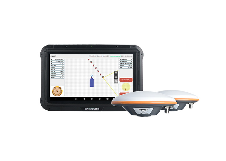
SingularPad Field Surveying Software
learn more








 2026-07-13
 Linden


In daily surveying workflows, different projects often require different base maps. SingularPad includes several built-in options—Google Maps (Standard), Google Maps (Satellite), and OpenStreetMap—that cover most common use cases.
However, some projects require specialized maps beyond the built-in selection. These may include topographic maps from national mapping agencies, cadastral maps from local authorities, or proprietary thematic layers from within your organization. Such data is typically published through WMS services and cannot be accessed through the default base map options.
To address this, SingularPad supports WMS map service integration, allowing you to connect to any standards-compliant WMS server and apply its layers as base maps in your surveying projects.
In this blog, we will introduce the basics of WMS and walk through the steps to configure a WMS service in SingularPad.
WMS stands for Web Map Service, an international standard developed by the Open Geospatial Consortium (OGC) for generating and transmitting map images over the internet.
When you pan or zoom in the map view, the client sends a request to the remote server. The server renders a map image (typically in PNG or JPEG format) based on the current view extent and returns it to your device. Each change in the view triggers a new request.
The key characteristic of WMS is that it returns server-rendered raster images rather than vector data containing geographic coordinates and attributes. This mechanism offers several practical advantages:
Low device requirements: Map rendering is handled on the server side, so even low-spec devices can display complex map layers smoothly.
Always up-to-date data: The data source is maintained on the server, requiring no local downloads or updates—you always see the latest version.
Broad compatibility: WMS is an open standard supported by numerous government agencies, mapping organizations, and commercial providers worldwide.
In the following tutorial, we'll use the free OpenStreetMap WMS service at okmaps.org/geoserver/wms? as an example. The same workflow applies to any WMS server you have access to.
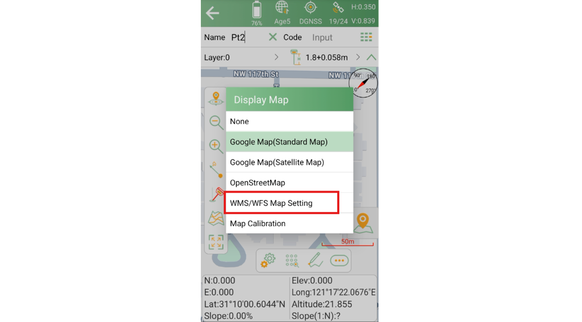
Go to the Point Survey screen, then tap the Map icon in the left toolbar to open the base map selection panel.
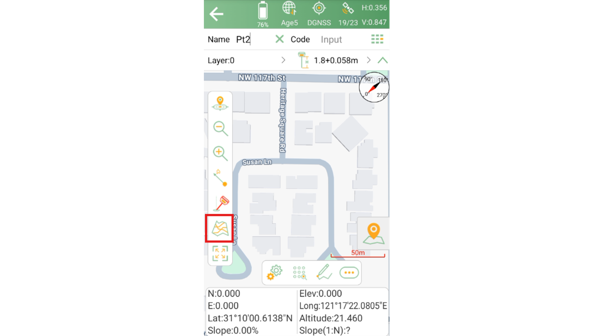
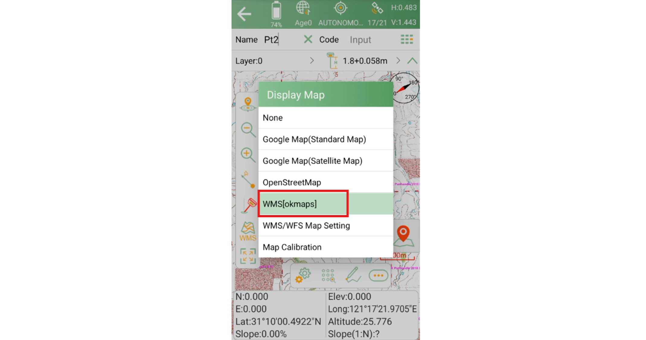
The panel lists the built-in map options, including Google Maps (Standard), Google Maps (Satellite), and OpenStreetMap. Below these options, you'll find an entry labeled WMS/WFS Map Setting—tap it to open the WMS configuration page.
On the WMS/WFS Map Setting page, tap the Add button at the bottom to create a new WMS service connection.
This opens the Connect WMS Server screen, where you'll enter the server information.
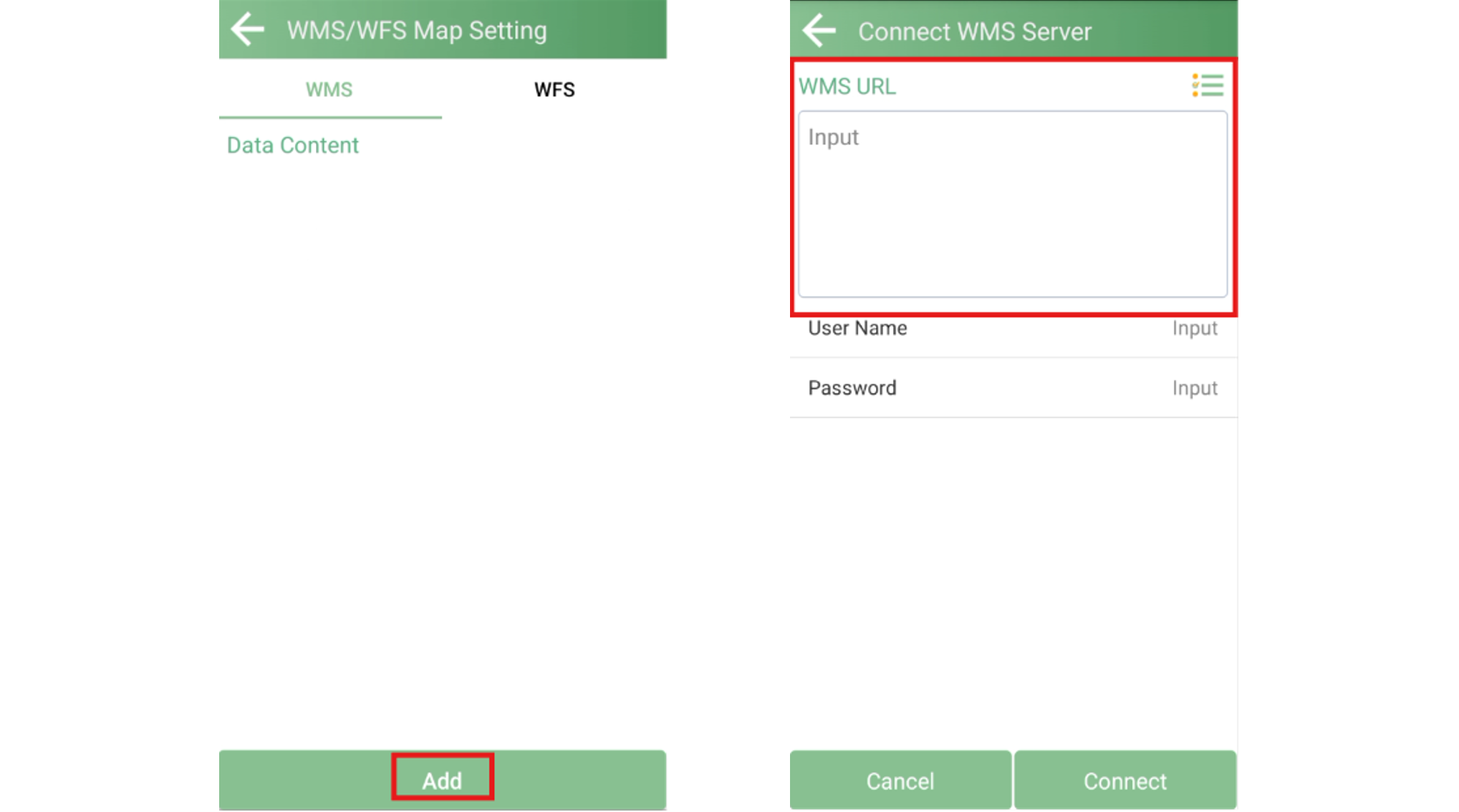
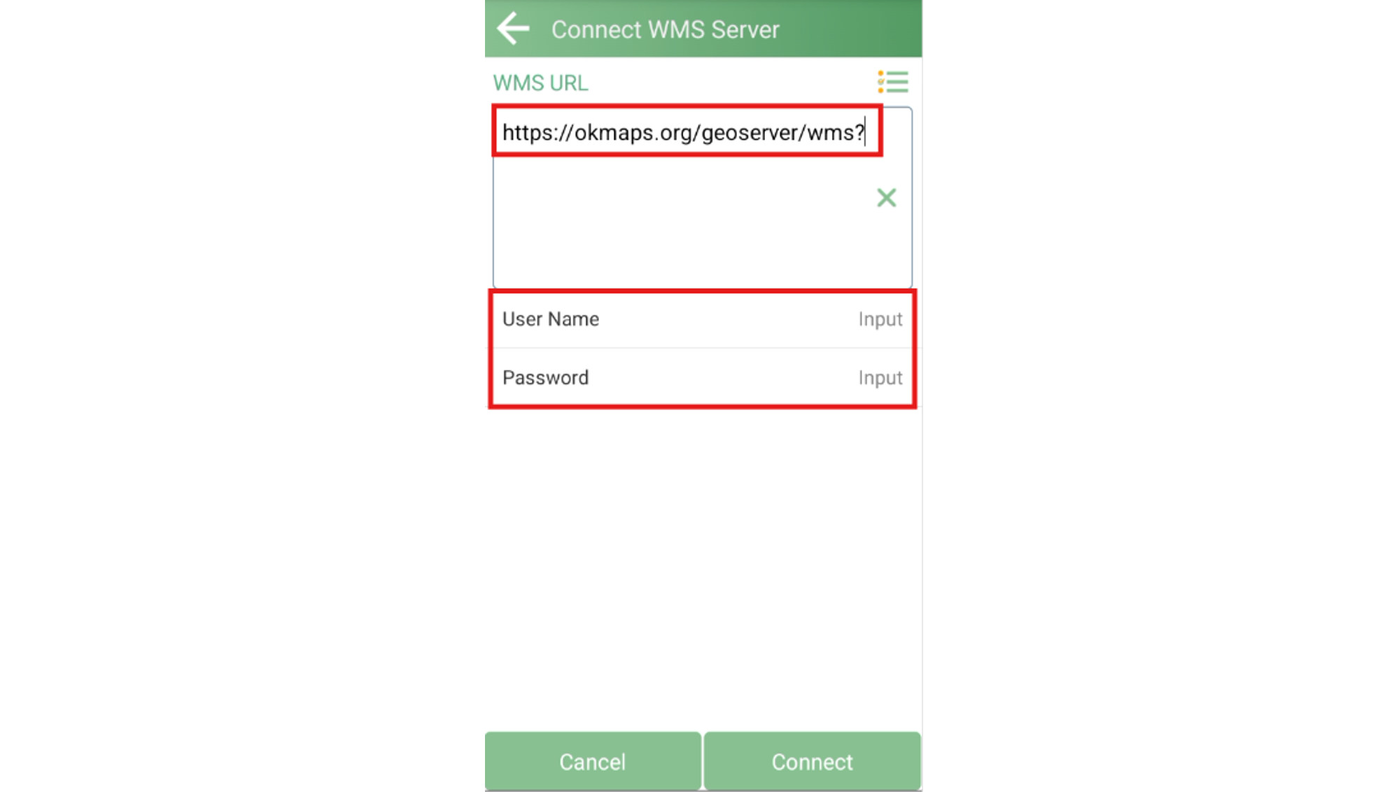
In the URL field, enter the WMS service address. For this example:
https://okmaps.org/geoserver/wms?
If the WMS service requires authentication, enter the credentials in the Username and Password fields below. For public services like the one in this example, simply leave these fields blank.
Tap the Connect button at the bottom. SingularPad will connect to the server and retrieve a list of all available layers published under that service.
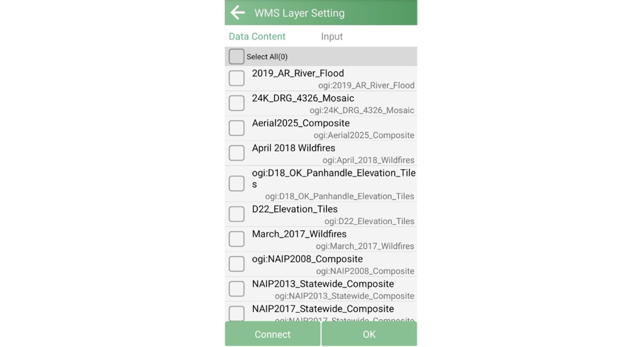
If the server provides a large number of layers, use the keyword search at the top of the page to quickly filter for the ones you need. Multiple layers can be selected at once.
After making your selection, tap OK. A confirmation prompt will appear—you can keep the default layer name or enter a more descriptive one. Tap OK to save.
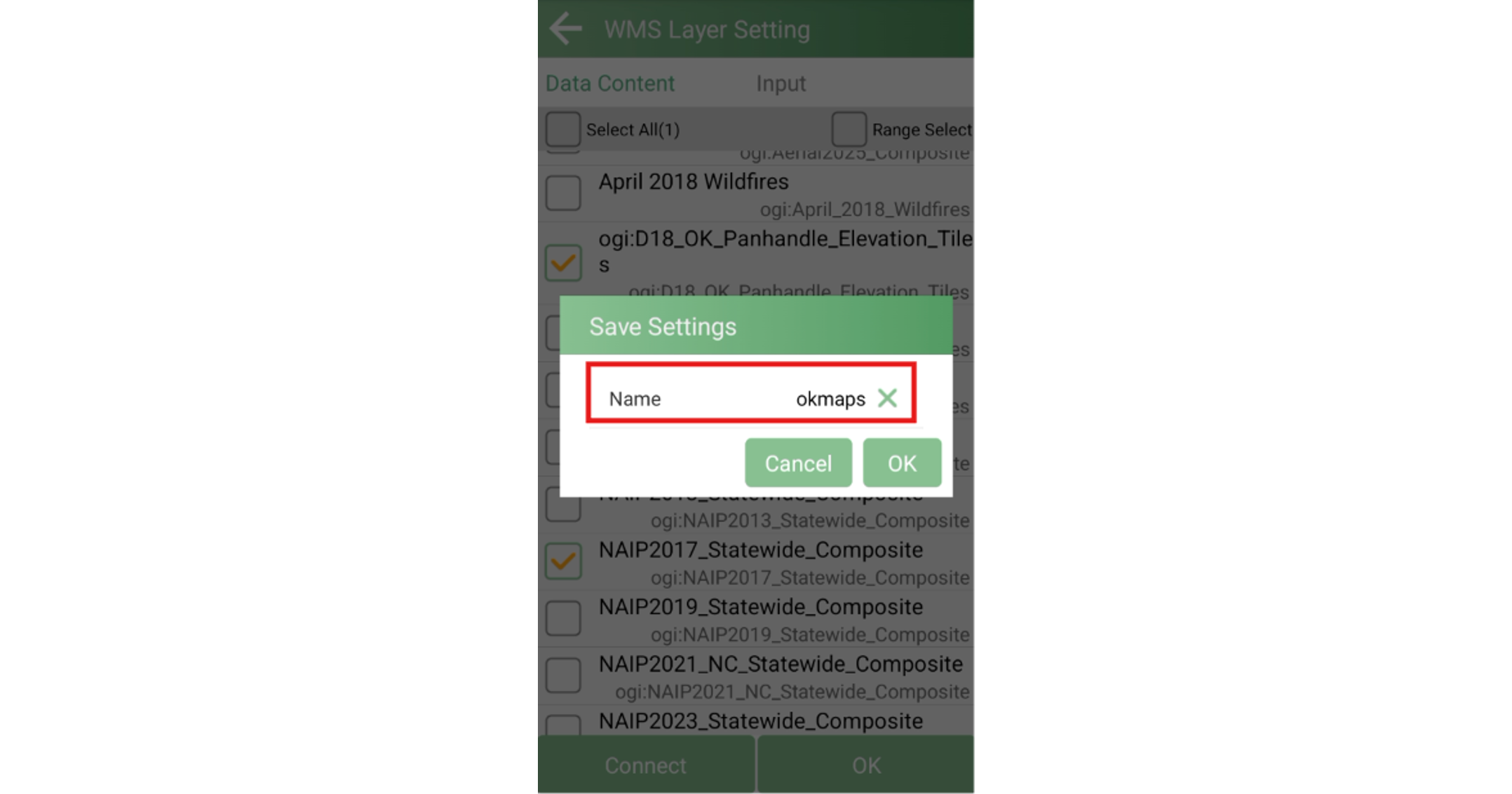
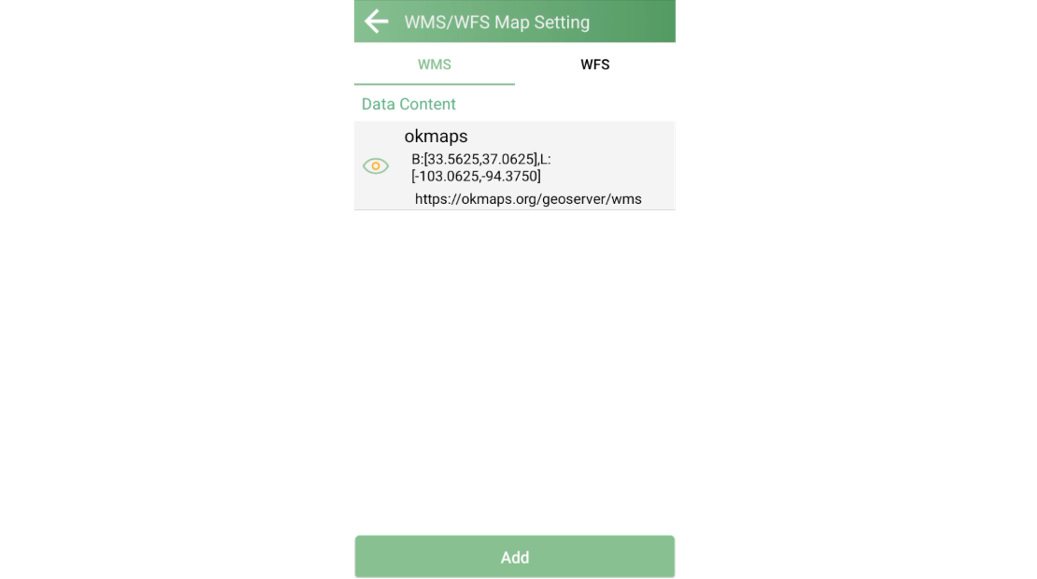
Once saved, the newly added layer will appear in the WMS Data Content list on the WMS/WFS Map Setting page.
Return to the Point Survey screen and tap the Map icon in the toolbar again. The base map list now includes the WMS layer you just added.
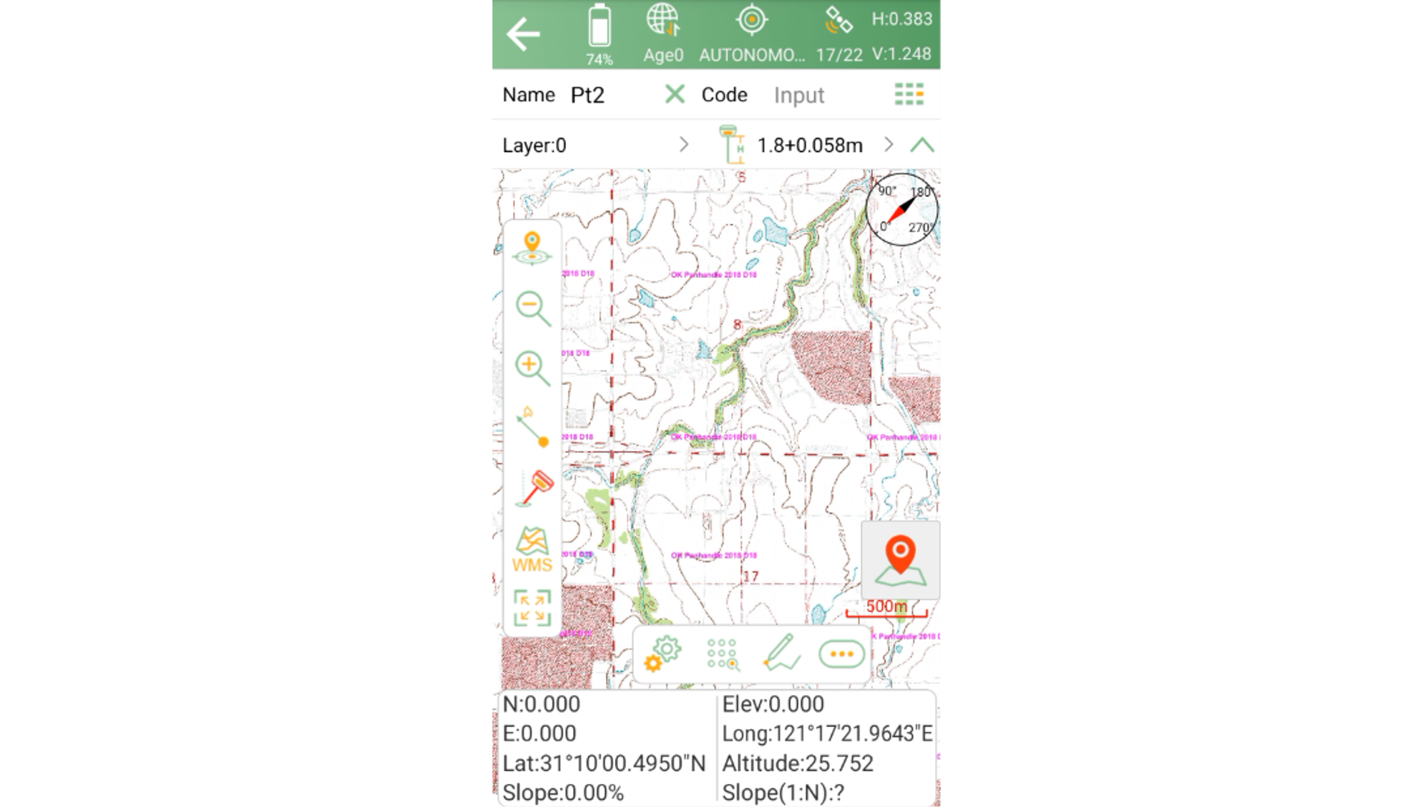
Tap the layer to set it as the current base map. SingularPad will automatically request and load map imagery for your current location.
From then on, as you pan or zoom in the survey view, SingularPad will continuously fetch the corresponding map tiles from the WMS server, keeping the base map in sync with your current view.
Test the service URL in a browser first: Before configuring the service in SingularPad, open the WMS URL in a desktop browser to confirm the server is online and responding correctly. This helps rule out connectivity issues before heading into the field.
Use descriptive layer names: When saving layers, use descriptive names instead of the default ones. Clear naming makes it easier to identify and select the right layer when multiple WMS layers are configured.
Check service coverage: Not all WMS services provide global coverage. Services hosted by regional authorities may only support map display for specific countries or areas. Confirm that the service covers your project area before heading to the field.
Be mindful of field network conditions: WMS relies on a real-time network connection to fetch map tiles. If your work area has no mobile network or Wi-Fi coverage, WMS layers will not load.
Clean up unused WMS connections: If a WMS layer is no longer needed, remove it from the WMS/WFS Map Setting page to keep the base map list clean and avoid accidental selection.
SingularPad's WMS integration enables connection to virtually any standards-compliant map service, greatly extending the range of available base maps. By understanding how WMS works and following the steps above, you can integrate thematic map layers from government agencies, commercial providers, or internal organizational sources directly into your surveying workflow.
This is especially useful for projects such as cadastral surveying and infrastructure planning that require authoritative base map references—having the right map in the field can significantly improve both accuracy and efficiency.
If you encounter any issues while configuring WMS services, or need help finding a suitable server for your region, feel free to reach out to our support team.